5 Ways Geofences Provide More Control Over Your Fleet


School transportation departments face a daily collection of challenges. Chief among them are keeping students safe and reducing costs. Over recent years, GPS tracking has become a staple for tracking fleet vehicles, but using geofences takes that location data and provides additional insights to make fleet management more effective.
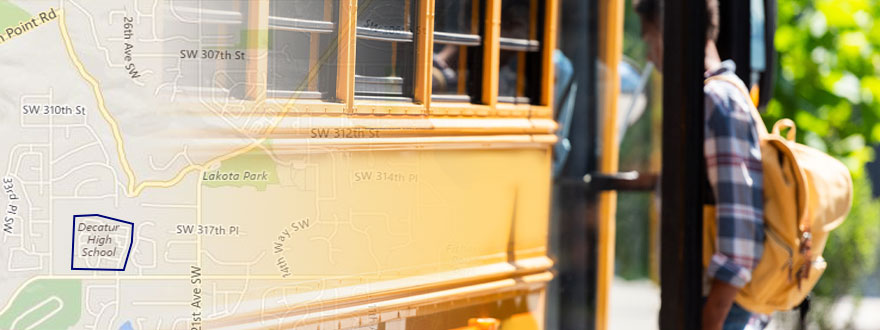
A geofence is a virtual fence drawn around a physical geographic location or area. Equipping your school buses with GPS tracking (if you haven’t already) and drawing geofences on the backend gives you greater insight into and control over each bus’s movement.
More insight and control translate into safer students and a more efficiently run fleet.
Ensure buses run authorized routes only.
Many bus drivers do their job and do it well. Some don’t. Creating geofences around authorized and unauthorized areas will show you exactly who’s operating responsibly and who’s going off route or spending too much time in one location, which can increase expenses or liability. Recognize those who follow procedure; hold accountable those who don’t.
Know when school buses depart and arrive.
Transporting student riders on time is critical. By drawing geofences around bus yards, stops and destinations, you can monitor, in near real time, when they leave later than scheduled. Know when they depart, when they arrive and if they’re too long in between scheduled destinations.
Save on unnecessary toll road fees.
Drivers know how important sticking to the schedule is and to do so, some take short cuts on toll roads instead of sticking to the planned, authorized route. While some school districts are forgiven toll fees, others are not. If yours is not exempt from toll fees, creating geofences will show you who’s using unauthorized toll roads—and costing you unbudgeted costs.
Protect your fleet and your community.
How often do people call to report that one of your buses was speeding? Use geofencing to draw a line through the street included in the complaint and view a history of vehicles that have traveled on that road. Look at the data to verify the speed at which those vehicles were moving—and if they were even your vehicles. Hold unsafe drivers accountable, and exonerate wrongly accused drivers to protect your fleet from false claims.
Stopping distance only includes the time required to stop—not the time required to notice the need to stop. And one vehicle can follow another too closely for speed and conditions without technically tailgating. Drivers under the influence of highway hypnosis need more time to notice the situation before applying the brakes—and therefore more stopping distance.
Streamline certain aspects of managing your fleet.
Choose a smart fleet management solution that includes a flexible, secure online portal with a selection of features that make geofencing effective and efficient. Among these features should be real-time alerts sent to your phone or email, so you can stay informed.
You should also be able to:
- Map every turn of the key, every stop and start, and activity
- Easily measure driver performance, such as speed, path, safety and idling
- Customize reports, alerts and dashboards
- Automate tasks that are often considered a burden
Ground Traffic Control®, our online web portal, features all of the above. Track school bus locations in near real time, and draw geofences around specific locations to regulate and restrict bus activities. The more closely you regulate bus activity the safer you keep student riders and the more efficiently you manage your fleet.